My walk to town
On a beautiful morning last week I took my usual route to town.New Plymouth is full of history, no part more so than the neighbourhood where we live. Our house is the cottage behind the house in the foreground.
Behind both houses, both re-sited on this double section about forty years ago, you can see the trees which adorn the top of the hill. In pre-European days it was a kainga called Wharepapa. During the war scares in 1860 it was turned into a fort, one of a ring that served as outposts defending the town.
It was named, after the navy ship its builders served in, Fort Niger, and the reserve is still called by that name.


At the other end of the next block is a building now used as a backpackers' hostel.
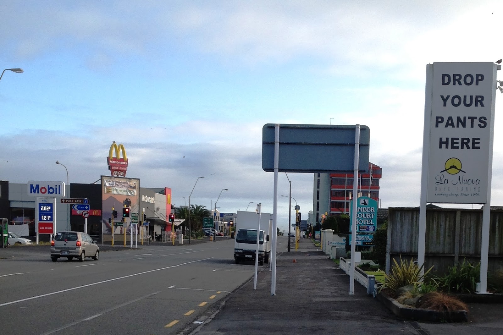
When you turn at the dairy and face the north, as I do, you get this view on the left.
McDonalds is right in front of us now, so you can see we are not far from morning tea and the kids' play area when we have the grandchildren with us!

At the next intersection, we glance to the left, west, to see the traffic coming along State Highway 45 (Surf Highway).
Eliot Street behind us is part of State Highway 3 from Hawera, and Courtenay Street, heading east, is the continuation of Highway 3 towards Waitara and Hamilton.
Courtenay Street is named after the family of the Earls of Devon, especially Henry who was the Chair of the Board when New Plymouth was being planned.
The next corner is where Eliot Street crosses Devon Street, New Plymouth's nominal main street, and also named after the Earl of Devon (below).
Here, Eliot Street forms part of Highway 44, which connects Highway 3 with Port Taranaki, and has lots of heavy vehicles like logging trucks and oil tankers, thundering along it.

The photo below is taken further west along Devon Street and shows the unprepossessing building of the Sunworld restaurant on the left.
In the centre of the photo is the State Hotel, originally called the Red House, on the corner of Gover Street.

Behind that is the TSB Bank head office building. Taranakians are very proud of their own bank, and the fact that it is one of the few banks still owned by New Zeralanders.
Every year the profits of the banking business are distributed to public and charitable organisations throughout Taranaki to assist with various community projects.

There are at least three other discount stores close to the city centre where I can find much of the same art requirements.
In the next photo we have moved on to the frontage of the TSB bank building. Here are the bank branches whose signs you can read, but also our local branch of the bank where we do our business.

In the last view of our walk to town, we have moved another few metres west and are now just about outside the Trade Aid shop. In the eighties Marg and I worked as volunteers and shop committee members for Trade Aid, and were part of the organisation when the shop moved into the central business area, near its present site.
The traffic lights at the end of the block mark New Plymouth's central intersection. This is where the inner defence of the wartime town, a trench and watchhouse ring, had its eastern limit.
To the right of the traffic lights you can see the top of the facade of the new Len Lye Centre on the skyline.
But the walk along to that part of town needs another blog!

No comments:
Post a Comment